
Why Mexico City Shakes and Sinks at the Same Time
Mexico City faces two linked risks: earthquakes amplified by soft soil and sinking ground driven by groundwater pumping and weak drainage.
Mexico City knows how to react when the seismic alarm sounds. People leave offices, schools pause classes, and residents check their phones for emergency alerts. But the capital’s risk is not only what happens during a tremor. New satellite data shows parts of the metro area sinking by more than two centimeters per month. The same ground that can amplify shaking can also bend streets, pipes, Metro lines, and homes. The danger is slow, uneven, and already visible.
Mexico City’s Two Slow-Motion Emergencies: Earthquakes Above, Subsidence Below
Mexico City was reminded Monday morning again that earthquake risk is part of daily life in the capital.
A magnitude 5.6 earthquake struck near Pinotepa Nacional, Oaxaca, on May 4, triggering seismic alerts in Mexico City and sending people into the streets, sidewalks, and meeting points. Authorities reported no immediate deaths or major damage, but the event exposed a newer concern. Many residents did not receive the expected cellphone earthquake alert because the mobile warning platform was under maintenance ahead of the May 6 national drill.
The timing was hard to ignore. Two days after a real tremor, Mexico is scheduled to hold its First National Drill of 2026, with sirens, public loudspeakers, emergency messaging, and cellphone alerts set to be tested across the country.
For many residents, the immediate question is simple: will the alert work when it matters?
But the deeper question is larger than one missed cellphone warning. Mexico City is managing several risks at once. It is exposed to strong earthquakes from the Pacific coast. Its soft lakebed soils can amplify shaking. Its water system depends heavily on groundwater extraction. That extraction is helping the ground sink. The sinking damages homes, drainage, water lines, streets, and parts of the Metro system.
These are not separate problems. They overlap under the same city.
Why Mexico City shakes so much
Mexico City is not on the coast, and it is not directly above the country’s main subduction zone. Still, it can be badly shaken by earthquakes that begin hundreds of kilometers away.
The reason starts with Mexico’s geography. Along the Pacific coast, tectonic plates meet and push against each other. The Cocos Plate moves beneath the North American Plate. That process creates many of the country’s strongest earthquakes, especially off or near Guerrero, Oaxaca, Michoacán, and Chiapas.
When a strong quake begins along the coast, seismic waves move inland. By the time they reach Mexico City, they may have traveled a long distance. In many places, that distance would reduce the danger. In Mexico City, the old lakebed can make shaking last longer and feel stronger in certain zones.
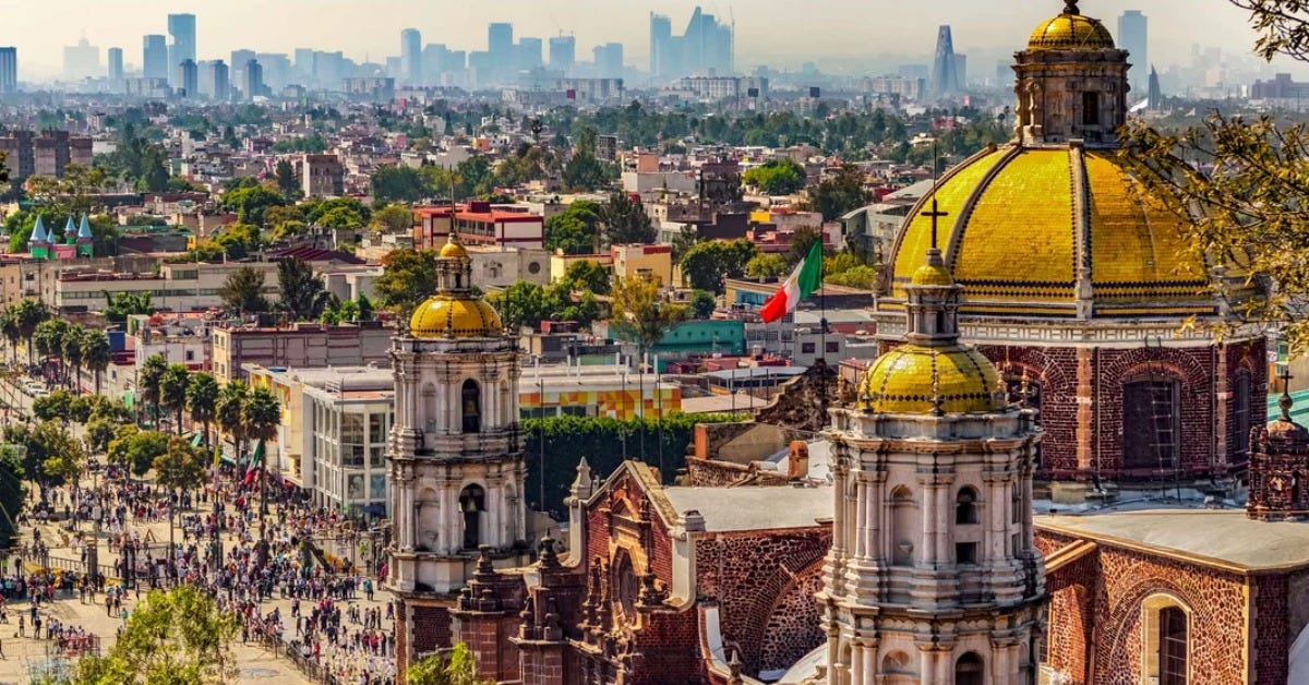
Much of the capital was built over the former lake system of the Valley of Mexico. The Aztec capital of Tenochtitlan was founded in a watery landscape of lakes, canals, wetlands, and islands. Over centuries, colonial and modern governments drained much of that lake system to expand the city and control flooding.
That left large parts of the city sitting on soft clay and lake sediments.
Those soils can behave like a bowl of gelatin during a quake. They do not create the earthquake, but they can increase the motion felt above them. In some areas, the ground can continue to move for longer than firmer ground on the hills and lava fields west and south of the city.
This helps explain why the capital suffered severe damage in 1985, even though that earthquake began off the Pacific coast. It also explains why damage patterns can seem confusing. One neighborhood may feel intense shaking, while another area only a few kilometers away feels less movement.
In Mexico City, local soil conditions matter almost as much as the distance from the epicenter.
The alert system is useful but not magic
Mexico’s seismic alert system is built around a practical idea. Sensors near high-risk seismic zones detect strong shaking close to where an earthquake begins. If the system calculates that a city may be affected, it sends an alert before the strongest waves arrive.
That warning can give people valuable seconds. In a tall office building, school, hospital, or apartment tower, even a short warning can help people move away from windows, stop elevators, open emergency routes, or begin evacuation if that is the building protocol.
But the system has limits.
The alert does not predict earthquakes. It only reacts after an earthquake has already started. The warning time depends on where the quake begins, how strong it is, and how far the affected city is from the epicenter. A coastal earthquake may provide more warning time for Mexico City. A quake closer to the capital may provide little or no warning.
This is why residents sometimes hear the alarm and feel no shaking. Other times, shaking can begin before some people understand what is happening. In a few cases, the system may not activate for a quake that people still feel.
The Mexican Seismic Alert System, known as SASMEX, remains one of the world’s better-known public earthquake warning systems. It relies on detection, fast communication, and public discipline. Its value depends not only on technology, but also on what people do after the sound begins.
Mexico City has built a strong evacuation culture because residents practice. Drills are not symbolic. They train office managers, guards, school staff, apartment building staff, and families to act quickly rather than debate what to do.
That culture is one reason the May 6 drill matters.
Why cellphone alerts became part of the story
For years, Mexico City residents depended mainly on public loudspeakers, radio, television, apps, and building alarms. The spread of cell broadcast alerts adds another layer.
Cell broadcast is different from a normal text message. It can send emergency alerts to phones in a selected geographic area without requiring an app, mobile data, or an individual subscription. The message is pushed through the mobile network to compatible phones in the target zone.
In theory, that makes it useful for earthquakes, hurricanes, floods, fires, and other emergencies.
But the May 4 quake showed why trust is fragile. The public loudspeaker alert sounded in Mexico City, but the mobile alert did not reach many phones because the platform was under maintenance. Authorities said the system was being prepared for the May 6 national drill and was later restored.
That explanation may be technically accurate, but it also points to a basic public safety issue. Emergency systems need maintenance, testing, backups, and clear communication. But residents expect them to work during real emergencies, not only during planned exercises.
Cell broadcast should be seen as a complement, not a replacement. Residents should not rely on a single channel. The safest approach is to treat every alert source as one part of a wider system: public speakers, building alarms, radio, phone alerts, family plans, and personal awareness.
A phone alert is useful. A practiced plan is better.
The other emergency is below the city
Earthquakes are sudden. Subsidence is slow.
That difference makes Mexico City’s sinking ground easier to ignore, even though it affects daily life across the metropolitan area.
NASA’s NISAR satellite recently measured parts of Mexico City and its surrounding area sinking by up to a few centimeters per month between October 2025 and January 2026. In some places, that is more than two centimeters a month, or roughly 24 centimeters a year if the rate continues.
This does not mean the entire city is sinking evenly. It means parts of the metro area are moving down faster than others. That uneven movement is the real problem.
When one block drops faster than the next, streets crack. Pipes bend. Drainage slopes change. Water lines break. Building foundations shift. Metro tracks and station structures require more maintenance. Old buildings may tilt. Newer buildings may face stress if the design, soil studies, or construction quality were poor.
The main driver is groundwater extraction.
Mexico City draws much of its water from underground aquifers. When water is pumped out faster than nature can replace it, the clay and sediment layers compact. Once those layers compress, they do not easily rebound. The ground loses elevation.
This is one of the capital’s oldest urban problems. It is also one of its hardest to fix, because it is tied to water supply, population growth, infrastructure, and climate stress.
Mexico City needs water. Pumping water helps the city function. But pumping too much water helps the city sink.
A city built on water now struggles with water
Mexico City’s water problem often appears in headlines as shortages, low reservoir levels, leaking pipes, or neighborhood service cuts. The sinking problem is part of the same story.
When groundwater is overused, the aquifer shrinks and the ground compacts. When the ground compacts unevenly, pipes break more often. Broken water pipes lose more water. Drainage systems lose their designed slope. Flooding can become harder to manage. More pumping may then be needed to move water out of low-lying areas.
That creates a difficult loop.
The city was once defined by water. Today, it fights both a shortage of clean water and an excess of stormwater during heavy rains. The rainy season can overwhelm drainage. The dry season can expose shortages. Subsidence makes both problems harder.
This is why flooding, sinkage, cracked streets, Metro problems, and water cuts should not be seen as unrelated complaints. They are often signs of a larger urban system under stress.
For residents, the most visible signs are usually local. A cracked wall in Iztapalapa. A tilted sidewalk in the historic center. Flooding near a Metro station. A water outage in a neighborhood that depends on tanker trucks. A road repair that returns again and again.
The slow emergency is not dramatic until it reaches a home, a station, or a street that people use every day.
Neighborhoods with overlapping risks
No single map can tell a resident everything. Earthquake risk, flood risk, subsidence risk, building age, construction quality, and maintenance history all matter.
Still, some patterns are clear.
The lakebed and transition zones tend to face stronger shaking than firmer ground. Central areas with older buildings, mid-rise apartment blocks, and dense development can be more vulnerable if buildings were not properly designed, reinforced, or maintained.
Subsidence has been especially serious in the eastern and southeastern parts of the metropolitan area. Areas associated with faster sinking include parts of Iztapalapa, Tláhuac, Iztacalco, Venustiano Carranza, Gustavo A. Madero, and parts of the surrounding State of Mexico, including areas near the old lake system.
Flood risk also clusters in parts of the center and east, though it changes by storm, drainage conditions, clogged streets, elevation, and local infrastructure. The same broad side of the valley that struggles with sinking ground can also face difficult drainage and flood exposure.
This creates overlapping risk in practical terms.
A neighborhood may not be the most dangerous place for every hazard. But if it has soft soils, older housing, visible cracking, poor drainage, and recurring water problems, residents should take the risk seriously. The question is not whether the whole neighborhood is unsafe. The better question is whether a specific building, street, or block has warning signs.
For renters and homeowners, that means paying attention to cracks that grow, doors that no longer close, uneven floors, persistent leaks, and official notices after inspections. For buyers, it means taking soil, structure, drainage, and building records seriously before signing.
In Mexico City, location is not just about commute time or restaurant access. It is also about ground behavior.
What this means for the Metro and other infrastructure
The Metro is one of Mexico City’s essential systems. It moves millions of people and connects neighborhoods that would otherwise depend on congested roads.
It also runs through a city where the ground does not sit still.
Subsidence can affect tracks, tunnels, elevated structures, drainage, station entrances, and maintenance demands. The risk is not that the entire system suddenly fails because the city is sinking. The concern is that uneven ground movement adds stress to infrastructure that already requires constant inspection and repair.
Drainage is another major concern. A drainage system depends on gravity, slope, pumping, and clear channels. When the ground sinks unevenly, the original design can be distorted. A pipe that once drained properly may lose efficiency. A low spot may collect water. A storm can quickly expose weak points.
Housing faces a similar problem. A building does not need to collapse to become unsafe or expensive to repair. Differential settlement can crack walls, twist frames, damage plumbing, and weaken foundations. Informal construction or poorly modified buildings face a greater risk.
This is where earthquakes and subsidence meet.
A building already stressed by sinking ground, poor maintenance, or unauthorized modifications may perform worse during shaking. A building on soft soil may face stronger motion. A building with past damage may need professional review, not casual reassurance from a neighbor or landlord.
Mexico City’s risk management is not only about reacting after the alarm. It is also about knowing which structures are already carrying hidden stress.
What ordinary residents should do
Preparedness in Mexico City should be practical, not dramatic.
Residents should know their building’s evacuation route, meeting point, and safest interior areas. They should understand whether the building protocol is to evacuate immediately or shelter briefly until the shaking stops. In many buildings, especially taller ones, leaving during shaking can be more dangerous than staying away from glass and heavy objects until the shaking ends.
People should also check phone settings for emergency alerts. On many phones, government or wireless emergency alerts can be disabled by accident. A resident should not assume the setting is active. It is worth checking before a drill, not during a real quake.
Families should have a basic plan. That means knowing where to meet, how to contact each other if mobile networks are overloaded, and who will check on children, older relatives, pets, or neighbors with mobility needs.
A small emergency kit is also useful. Water, flashlight, power bank, copies of documents, medication, cash, basic first-aid supplies, and a whistle can make the first hours after an emergency easier.
For housing, residents should document visible cracks with dates and photos. If cracks widen, doors jam, floors slope, or water leaks appear after shaking or heavy rain, the building should be reviewed by qualified personnel. Renters should notify landlords in writing. Owners should not delay inspections when structural signs are changing.
People living in flood-prone areas should keep documents and electronics off the floor during the rainy season. They should also know which nearby streets flood first and avoid walking or driving through moving water.
The goal is not to live in fear. The goal is to reduce surprise.
The May 6 drill is more than a routine exercise
The May 6 drill arrives at a useful moment because the May 4 earthquake exposed both strengths and weaknesses.
The public alert culture worked in many places. People recognized the sound and moved. Buildings activated protocols. Authorities began damage checks. But the mobile alert failure showed that newer systems still need public confidence.
The drill can help rebuild that confidence if it is clear, consistent, and honest.
Residents should use the drill to test more than whether a phone makes noise. They should time how long it takes to reach a meeting point. They should check whether stairwells are clear. They should check whether guards, managers, and tenants are aware of the same plan. They should confirm whether elderly residents or people with disabilities need help.
Businesses should do the same. A drill is not a performance for authorities. It is a way to find problems before a real emergency does.
Mexico City has decades of experience with earthquakes. That experience saves lives. But the city is changing, and the risks are changing with it. Cellphone warnings, satellite maps, updated building rules, drainage work, water planning, and neighborhood-level inspections all need to work together.
The capital cannot stop earthquakes. It also cannot reverse a century of sinking ground overnight.
But it can manage risk more effectively when residents and authorities treat these hazards as interconnected.
The lesson from May 4 is not only that the ground can shake. It is that Mexico City’s safety depends on systems people rarely see until they fail: sensors on the coast, antennas on rooftops, loudspeakers on poles, phones in pockets, pumps underground, pipes below streets, foundations beneath buildings, and water moving through soil that has been compressed for generations.
Earthquakes are the emergency people hear.
Subsidence is the emergency they live with.
Both are shaping Mexico City’s future.